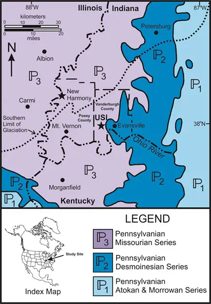
Southwest Indiana is on the eastern flank of the Illinois Basin at the convergence of the Ohio and Wabash Rivers. This area has a long history of geologic discovery from early 19th Century studies near New Harmony, to research focusing on the seismic risk along the Wabash Valley Fault Zone.
Geologic map of southwest Indiana showing the location of New Harmony and the University of Southern Indiana (USI). The bedrock underlying this area is Pennsylvanian in age and consists of alternating beds of sandstone, shale, coal, and limestone. Please also note the location of the southern limit of Illinoian glaciation. Geologic map modified from King and Beikman (1974).
In particular, there are several sites near New Harmony, Indiana with geologic significance. These sites were studied by Edward Travers Cox, Charles Alexandre Lesueur, David Dale Owen, Richard Owen, and Gerard Troost in the 19th Century. These sites were also visited by Leo Lesquereux and Sir Charles Lyell.
New Harmony is underlain by sandstones, limestones, shales, and coal of the Bond Formation (Pennsylvanian). This bedrock unit is overlain either by floodplain deposits of the Wabash River, or wind-blown silt (loess) deposited during the last Ice Age.
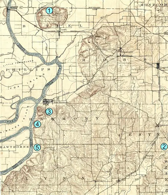
Topographic map of New Harmony and the surrounding area. Modified from the 1903 USGS topographic map (Scale - 1:62,500) of New Harmony.
Important localities for early geologists near New Harmony included:
Erosional remnant of loess and/or marl deposits; may be fault controlled.
Famous exposures of Pennsylvanian aged stumps of Didymophyllum owenii
Sir Charles Lyell while visiting D.D. Owen recognized this sediment as wind-blown.
Sandstone and limestone exposures studied by D.D. Owen, R. Owen, G. Troost, and E. Cox.
Plant fossil locality; D.D. Owen visited site with Sir Charles Lyell; collected and studied extensively by J. Sampson, E. Cox, and C.A. Lesueur.